Protecting the Texas Coast: The Sabine Pass to Galveston Bay CSRM Project
The Sabine Pass to Galveston Bay Coastal Storm Risk Management (CSRM) Project is a comprehensive USACE initiative designed to mitigate the devastating impacts of storm surge along the upper Texas coast, an area repeatedly impacted by major hurricanes like Rita (2005) and Ike (2008).
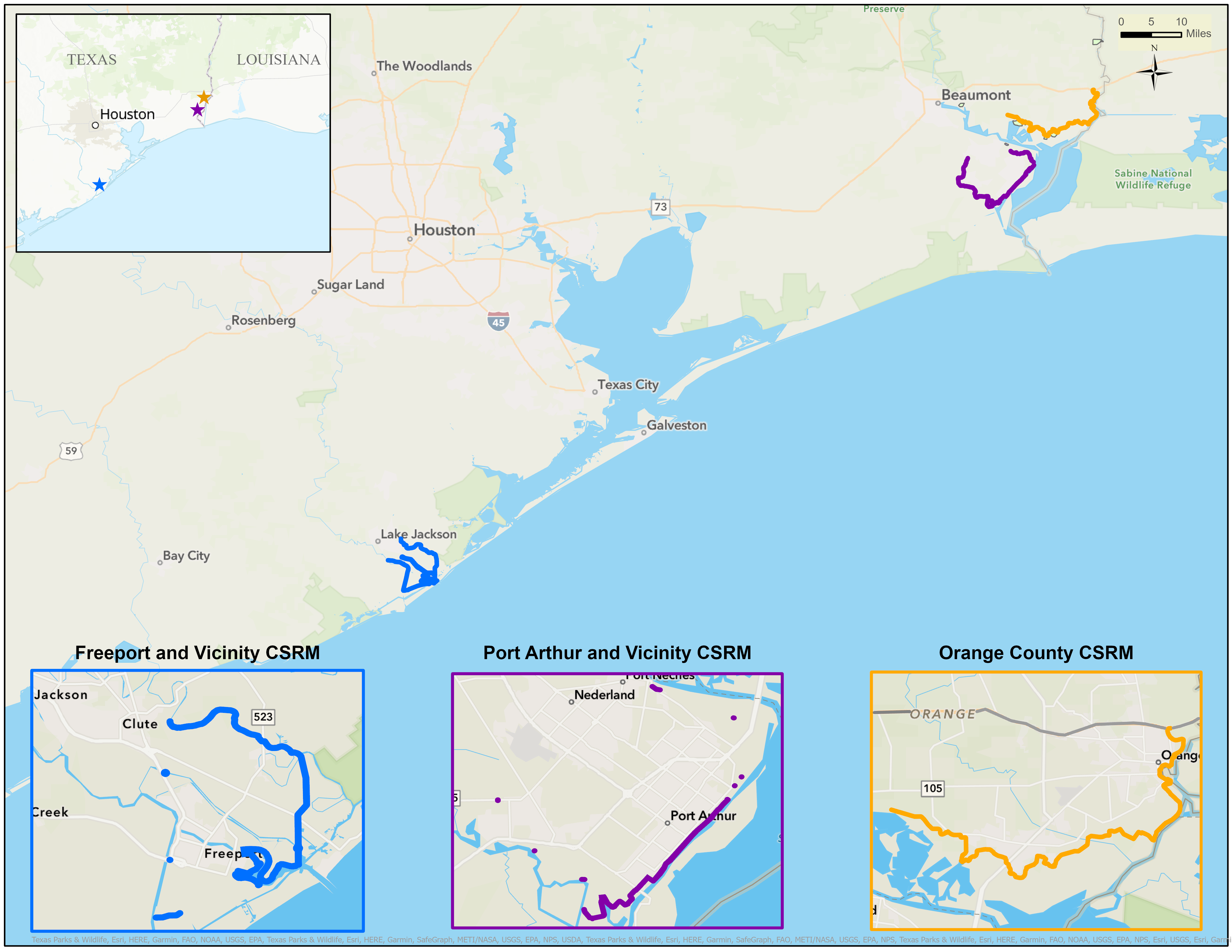
Authorized by Congress in 2018 and funded through supplemental appropriations, the project focuses on three key areas: enhancing existing hurricane flood protection in Freeport and Port Arthur, and constructing a new 26.7-mile levee system in Orange County. Currently in various stages of pre-construction engineering and design, and construction (Port Arthur), this project aims to reduce storm damage, protect communities, and safeguard critical infrastructure across Orange, Jefferson, and Brazoria Counties.
For more information on the S2G project, view our GIS StoryMap. The StoryMap allows you to:
- Learn about the history of the project.
- Experience a virtual landscape with the recommended risk management systems in place
- See the difference in flooding this project could make in the protected areas.
- Examine potential environmental impacts and review our plans for construction.
The Sabine Pass to Galveston Bay CSRM Project recommendation includes:
- Port Arthur: Increasing the level of performance and resiliency of the existing Port Arthur and Vicinity HFPP project in Jefferson County.
- Orange County: The construction of a new levee/floodwall system along the edge of the Sabine and Neches River floodplains from Orange to the vicinity of Orangefield that is approximately 26.7-miles. Link here for Video