Project Location

NOTE: For the latest info on the Wallisville Lake Project recreational opportunities, please contact the project office for updates (409) 389-2285.  

Take I-10 east from Houston to exit 807. Continue on east on the feeder road to the Trinity River Island Recreation Area. Turn right (south) through the gate and drive approximately two miles to the recreation area. From the Beaumont area, take I-10 west, take exit 807.  Continue west on the feeder road and through the intersection at the underpass. Continue west on the feeder road, it will turn-around under the interstate at the Trinity River. You will pass the Bird Rookery to the Army Corps Road. Turn right and go through the gate and drive approximately two miles to the recreation area. The office and visitor center are in the building with the green roof. There’s room for RV’s, vehicles with or without trailers. Handicap accessible parking is also available.

Hunting Programs - Small Game Hunting Permits

Wallisville Lake Project Small Game Hunting Permits Available February 1 - May 31, 2024

A small game hunting permit is required to hunt rabbits, squirrels, and nutria on the Wallisville Lake Project. Applications for those wishing to hunt small game are accepted from February 1 though May 31 annually. Permits are limited to 50 and are issued on a first-come-first-served basis. To obtain a permit, you must complete a 2024 Small Game Hunting application and email it to huntwallisville@usace.army.mil.

Documents:

For more information:  2024 Small Game Hunting Permits News Release

Hunting Programs - Feral Hog Hunting and Trapping

A feral hog dog hunting or trapping permit is required to hunt feral hogs on the Wallisville Lake Project.  Applications for those wishing to hunt feral hogs with dogs are accepted throughout the year. A maximum of 50 permits will be issued on a first-come-first-served basis. Applications for those wanting to trap feral hogs are accepted throughout the year. Completed applications should be emailed to huntwallisville@usace.army.mil. (Photo U.S. Department of Agriculture Animal and Plant Health Inspection Service).

Applications

Regulations

For more Information:  Feral Hog Removal Program News Release


Wallisville Lake Project Office

Wallisville Lock Project

Project Purpose: The Wallisville Lake Project was originally authorized by Congress for five purposes: navigation, salinity control, water supply, fish and wildlife enhancement, and recreation.  These purposes are still current today even though the Project is much different now than originally conceived.  The Trinity River is navigable by pleasure boats from its mouth and north as far as Liberty, Texas.  The Galveston Bay area shrimp fleet utilizes the Trinity as safe harbor during major hurricane events.  The Wallisville Lock and Dam and Structure A provide for salinity control by opening and closing depending on tides, river flows, winds, and drought conditions.  The Trinity River is a major source of water for the Houston metro area, for several smaller communities, and for irrigation canal districts in both Liberty and Chambers Counties.  Unlike most other Corps projects, Wallisville has no impounded reservoir so the bottomland forests, grasslands, streams, marshes, swamps, and pools are still preserved as natural habitats for a wide variety of fish and aquatic animals.  Depending on tides and fish movements, anglers could find marine species one day and fresh species the next.  Birds, such as colonial waders, shore birds, waterfowl, songbirds, and raptors call Wallisville home for breeding, wintering, or temporary residence during migration.  Mammals large and small find forage and shelter in the grasslands, forests, and swamps.  And we must not forget our large reptile, the American alligator.  Except for the coldest part of the winter, visitors can expect to see alligators, sunning along stream or pool banks, or swimming in the Project’s waters.  Parks, Recreation Areas, and the Visitor Center provide opportunities for picnicking, hiking, birding, primitive camping, fishing, canoeing and kayaking, and other activities for visiting families.  Fishing can be enjoyed year-round and during waterfowl season hunters can try their luck and aim on the many waterfowl that migrate through the project.

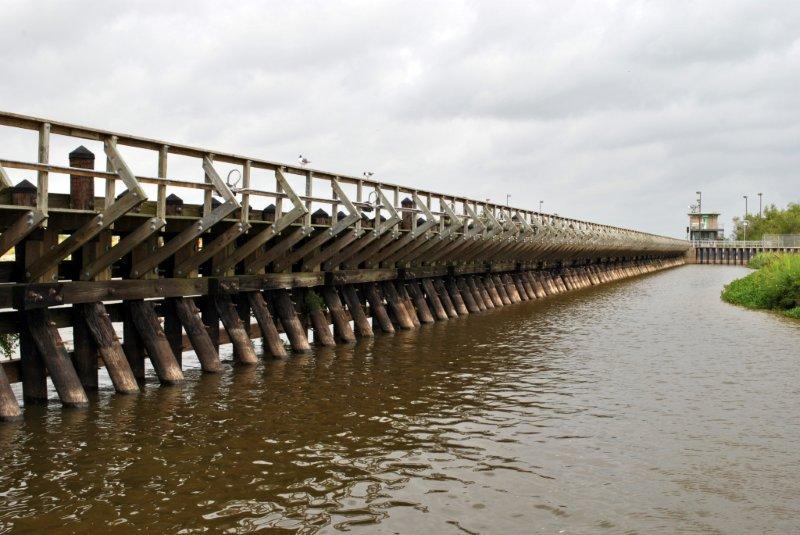
Project History:  Efforts to construct a saltwater barrier and/or reservoir at Wallisville on the Trinity River began in 1952.  Congress first authorized the construction of the project through the River and Harbor Act of October 22, 1962. The government purchased the property and construction began in 1966.  At this point, the project would have been a 19,700 acre reservoir with surface elevation of four feet above mean sea level.  A contract for water supply, salinity control, and recreation was signed between the U.S. Army Corps of Engineers, the Trinity River Authority, the Chambers-Liberty Counties Navigation District, and the City of Houston and was approved by the Secretary of the Army on February 2, 1968.  In September 1971, a lawsuit was filed by the Sierra Club in U.S. District Court against the construction of the project.  At approximately 72 percent complete, the construction was halted in 1973 by a summary judgment decision of the court.  Between 1973 and 1987 the project was revised and reevaluated.  And in May of 1987 the Fifth Circuit Court of Appeals dismissed the lawsuit in favor of the government and lifted the injunction against continuing construction.  Then in November of 1989 a pair of nesting bald eagles was discovered near Miller Lake and the project was reevaluated again.  It was this reevaluation that gave rise to the project as it stands today: a set of levees along the east and west banks of the Trinity in conjunction with the dam across the Trinity, the navigation lock and engineered navigation channel, the gated control structure on main stem of the Trinity, Structure A in the Cut-Off near Pickett’s Bayou, Structure B at the head of Lost River, and our parks and recreation areas.  The original 39,000 feet long concrete dam structure across the marsh was abandoned after it was breached in 2001 to allow for normal water flows of the Old River and several smaller streams and bayous.  Cedar Hill Park was completed in October 2000 and is leased to Chambers County for operation and maintenance.  The JJ Mayes Wildlife Trace was opened to the public in May 2003.  Hugo Point Park was opened in August 2003 and is leased to Chambers County for operation and maintenance.

Wallisville Lake Project Map

Galveston District Wallisville Lake Project

Mailing Address:
USACE Galveston District 
P.O. Box 293
Wallisville, TX  77597


Email:
swgpao@usace.army.mil
Phone:
(409) 389-2285
Fax: (409) 389-2389

Project Area History

187 archeological sites are recorded on Wallisville Project lands dating from about 1700 BC through the mid twentieth century.  Two areas are listed as National Historic Register Districts: Orcoquisac Archeological District and the Old Wallisville Townsite.  In 1984, 19,700 acres of the Wallisville Project were determined eligible as a National Register District.  164 of the archeological sites are shell middens and 23 sites are from the presidio, mission, town site, and home sites scattered across the project.  No other area along the Texas coast has been so thoroughly inventoried for existing archeological sites.  The shell midden sites primarily consist of rangia clam and/or oyster shells discarded by the early Native Americans who used the clams and oysters as staple food sources.  Akokisa, Arkikosa, and Orcoquiza are alternate spellings of the names used for these Native American peoples.  In 1756 AD the Spanish established Presidio San Luis Agustin de Ahumada del Orcoquisac and Mission Nuestra Senora de la Luz to help prevent French settlement and trading with the Orcoquiza and Bidai who were living in the area at that time.  The Presidio was garrisoned with Spanish troops through 1771.  It was officially abandoned in 1772.  The missionaries were the last persons to leave the site.  For more information on these early days see the website for the Southwestern Historical Quarterly online.  Search on “Spanish Activities on the Lower Trinity River, 1746-1771”.  The Wallisville area began to be settled by illegal immigrants from the United States in 1810.  Legal immigration began with Elisha Henry Robert Wallis and family in 1824.  The Wallis’s were part of Stephen F. Austin’s “Old 100” group of settlers.  Elisha HR Wallis’s sons Daniel and Solomon were instrumental in the founding of the town of Wallisville in the year 1854.  Trading, ranching, and logging were major activities of the settlers.  Steamer traffic began in 1838 with the vessel, the Branch T. Archer and by 1893 at least 100 steam powered vessels plied the Trinity.  From 1858 – 1908 Wallisville served as county seat for Chambers County.  A thriving community, Wallisville’s businesses included sawmills, stores, the first newspaper in Chambers County, Baptist, Catholic, Methodist, and Presbyterian churches, schools, a saddle shop, a cotton gin, a hotel and boarding houses, physicians and attorneys.  The town suffered major damage by the 1875 hurricane and was almost completely destroyed by the hurricane of 1915.  For more information on historic Wallisville see the website for the Southwestern Historical Quarterly online.  Search on “Wallisville”.  Or you can visit the Wallisville Heritage Park on the south feeder road of I-10 just east of the project entrance.